CAD in. Dirt numbers out.
Upload a DWG exported from CAD with elevation data and run a complete cut/fill takeoff without creating a project or waiting on a progress bar.
 MenuBook a discovery call

Dialogica turned a calculation that took expert operators hours into a focused platform that produces dependable dirt numbers, visual maps and field-ready grade checks in minutes.
Grading and civil contractors already receive the files they need: engineer CAD drawings, surveyed surfaces and site data. Turning those files into dependable quantities was the bottleneck.
Leteligence's founder built cut/fill models and earthwork calculations by hand for clients. Even with expert experience, every takeoff took two to three hours. For most estimators, the same work takes four to six.
The opportunity was not another desktop CAD tool. It was a browser-based workflow that understood the files contractors already had and delivered the answers they actually needed.
Leteligence Pro brings takeoff, surface analysis, measurement, map management and reporting into one shared workspace.
Upload a DWG exported from CAD with elevation data and run a complete cut/fill takeoff without creating a project or waiting on a progress bar.
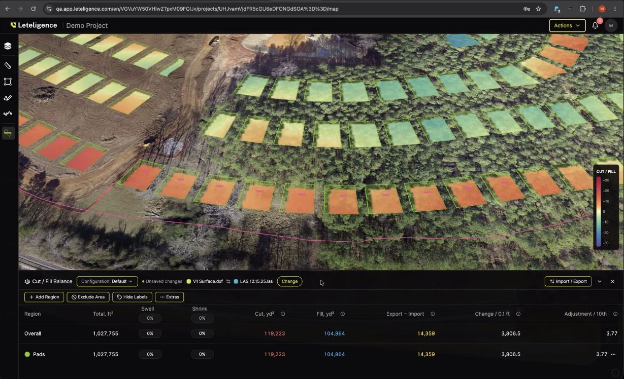
Compare surfaces, define regions and exclusion zones, calculate stockpiles and use a heat map to expose the deepest cuts and fills.
Point elevations, on-grade tolerance, profiles and surface-following distance measurements give crews practical checks without flattening the terrain.
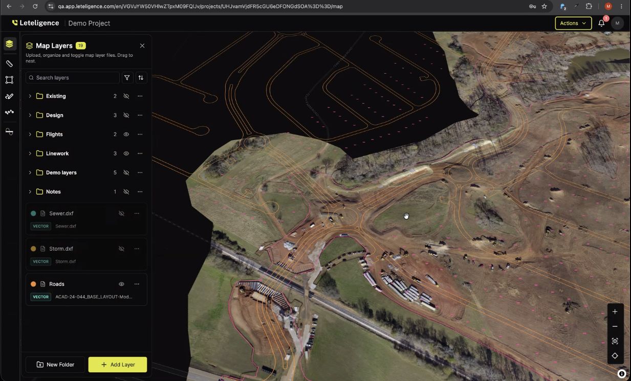
Organized layers, site photos, markups, notifications and PDF reports keep estimators, project teams and crews working from the same source of truth.
Add CAD files, surveyed surfaces and site data. Leteligence supports DWG, DXF, shapefiles and projection files.
Compare surfaces, run cut/fill, isolate regions, check elevations and calculate stockpile or site volumes.
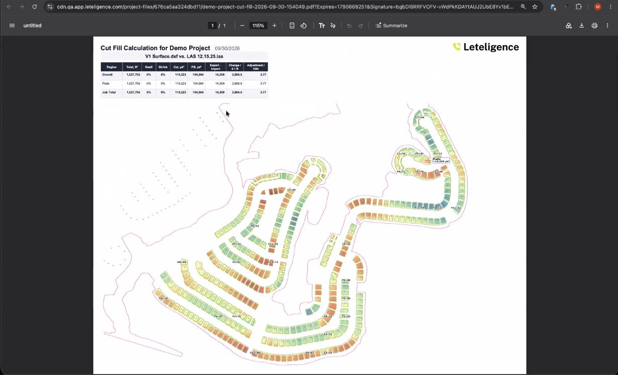
Mark up the map, export clear PDF reports and keep estimators, project teams and field crews on the same numbers.
The automation worked well enough to become a standalone company and product. Contractors can now get takeoffs and grade intelligence without owning CAD software, staffing a dedicated CAD operator or waiting days for answers.
The platform runs in the browser, supports English, Spanish and French, and pairs with Letel Metrics for drone LiDAR flights, control surveys and site scanning when the source data needs to be captured too.
Built by dirt guys, for dirt guys.
Leteligence Pro
Explore the product or talk with Dialogica about the workflow that should become your company's next custom platform.